StreetScape Module
Street Level Imagery
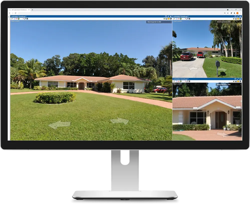
Powerful visual intelligence that supports desktop insights and decision-making while reducing the need for field visits.
Request a DemoComprehensive Street-Level Coverage
StreetScape offers powerful visual intelligence that supports desktop insights and decision-making while reducing the need for field visits.
Our mobile camera system captures images every fifteen feet, ensuring accurate coverage with state-of-the-art collection software.
High resolution photos provide the necessary detail for tax assessment purposes and can be customized for your application.
Key Capabilities
Mobile camera system captures images every fifteen feet
State-of-the-art collection software ensures accurate coverage
High resolution photos for tax assessment detail
Customizable for your specific application needs
Desktop insights that reduce the need for field visits
Powerful visual intelligence for decision-making
Comprehensive street-level property documentation
Seamless integration with GeoViewPort platform